Cimarron City Library Digital Archives
USDA Aerial Maps of Gray County KS
1976
(THESE ARE NOT STORED AT CIMARRON CITY LIBRARY)
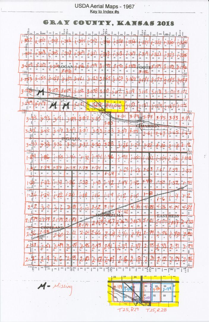
This digitized collection is an aerial survey of the entire county. It consists of 229 maps (283 images), including one Gray county plat map used as an index with the numbers written on by the conservation agents. The images were taken in swaths with the plane flying East and West. No dates were noted on the maps, so other than 1976, exact dates of photos are unknown. Also, there may be more than one Township/Range per map.
NOTES:Most of the maps that have the Index B designation were incorrectly numbered on the photographs. The Township should be T25 NOT T24. This has been noted in the inventory list in the “Notes” section. They have been placed in the correct locations in the scans.
MISSING 5 MAPS- Index F-7: T25 R29 S 25, 36 / T25 R28 S 30,31
- Index G-6: T26 R29 S 3,2,10,11
- Index G-7: T26 R29 S 1,12 / T26 R28 S 6,7
- Index G-9: T26 R28 S 1,12 / T26 R27 S 6,7
- Index K-9: T27 R28 S 3,2,10,11
The collection has been divided by Township/Range/Sections and can be found:
In the case of multiple Townships/Ranges per map, the image has been placed in each of the Township/Range folders.