Cimarron City Library Digital Archives
USDA Aerial Maps of Gray County KS
1967
(THESE ARE NOT STORED AT CIMARRON CITY LIBRARY)
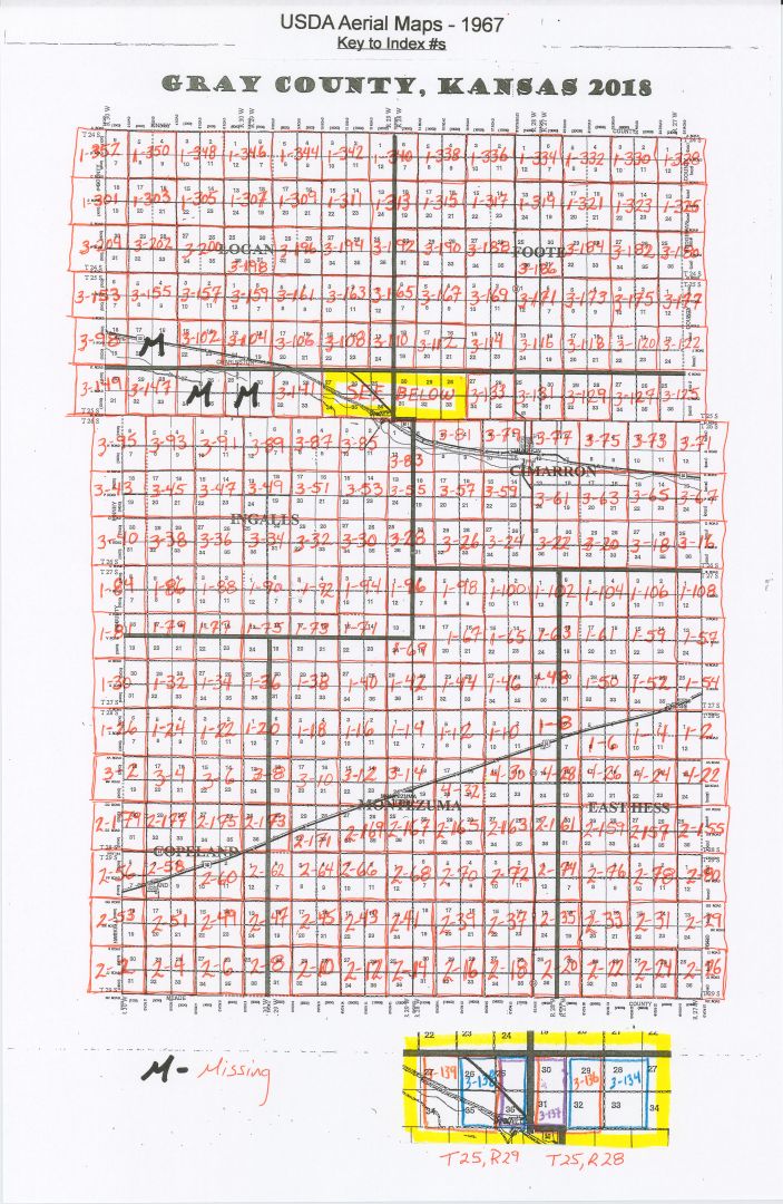
This digitized collection is an aerial survey of the entire county. It consists of 290 images, including an index created while inventorying the collection. The images were taken in swaths with the plane flying East and West (it seems in a rather haphazard fashion.) They started on April 28, 1967 and finished on the West side of the county on June 4, 1967. Most of the maps do not overlap, however a few do. It appears that several were accidentally overlapped (in T25 R29 & T25 R28), and then two were completely missed to the west of them: Index #3-143 & Index #3-145 (See below). Also, there may be more than one Township/Range per map.
- MISSING 1 AERIAL INDEX & 3 MAPS
- Index #1 – NE Corner of Gray County
- Index #3-100: T25 R30 S 17, 16, 20, 21
- Index #3-143: T25 R30 S 25, 36, ; T25 R29 S 30, 31
- Index #3-145: T25 R30 S 27, 26, 34, 35
The collection has been divided by Township/Range/Sections and can be found:
In the case of multiple Townships/Ranges per map, the image has been placed in each of the Township/Range folders.